Wildfires in Peru: what the satellite could measure
Updated:
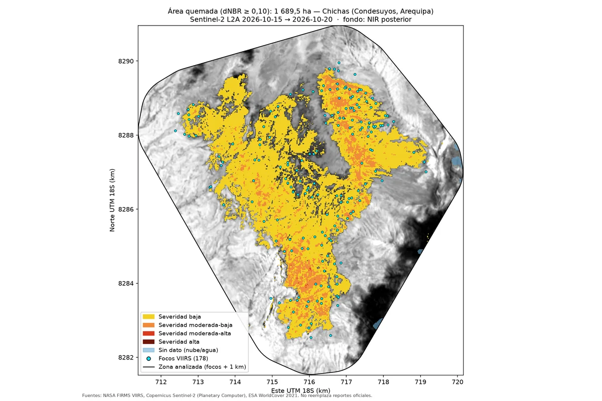
1,690 ha burned in an area with no hotspots recorded between 2012 and 2025
Question
How much burned in Peru's largest fires in October 2026?
Finding
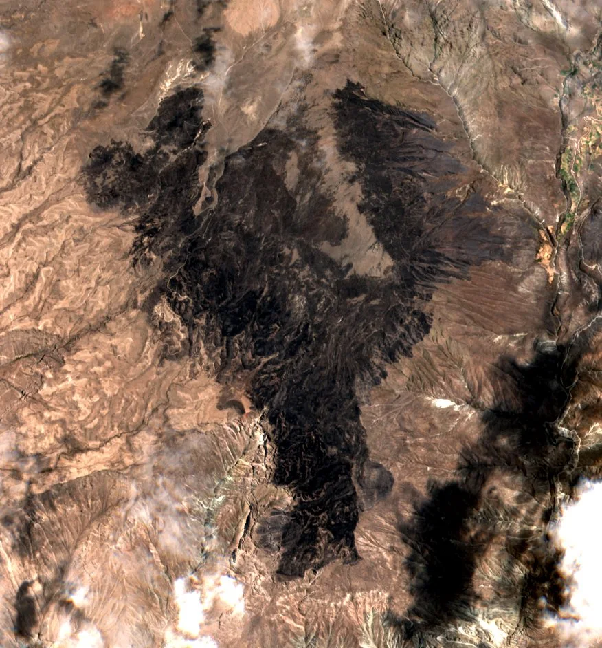
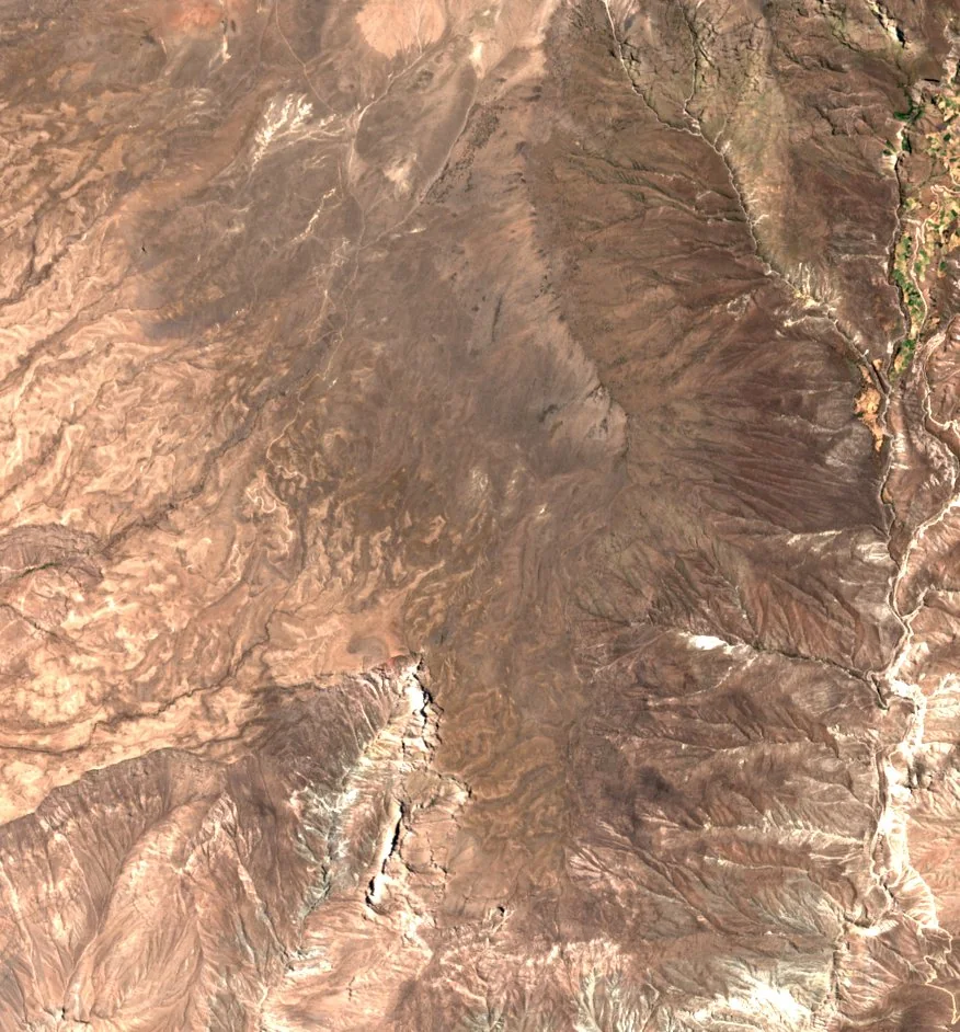
In Chichas (Arequipa), 1,690 ha burned, 4.3% of the district, in an area with no heat hotspot recorded between 2012 and 2025, which rules out recurring managed burning. Only 4 of the 20 largest fires could be measured; clouds covered the rest.
Before and after
Sources
The map combines heat hotspots from NASA FIRMS (VIIRS), Copernicus Sentinel-2 imagery from Planetary Computer and the ESA WorldCover 2021 land cover. The figures come from the repository and the project page. The map does not replace official reports.